Sunday, September 21, 2008

United States - Peace Bridge


Stamp Issue : 1977-08-04 

Peace Bridge is an international bridge between Canada and the United States at the east end of Lake Erie at the mouth of the Niagara River, about 20 kilometres upriver of Niagara Falls. It connects the City of Buffalo, New York and the Town of Fort Erie, Ontario. It is operated and maintained by the Buffalo and Fort Erie Public Bridge Authority.
The Peace Bridge consists of five arched spans over the Niagara River and a Parker through-truss span over the Black Rock Canal on the American side of the river. The total length is 1,768 m. Material used in the construction included 1,067 m of steelwork, 9,000 tons of structural steel and 800 tons of reinforcing steel in the concrete abutments. The Peace Bridge was named to commemorate 100 years of peace between the United States and Canada.
It was constructed as a highway bridge to address the needs of pedestrian and motor vehicle traffic which could not be accommodated on the International Railway Bridge, built in 1873.


Saturday, September 20, 2008

France - Pont de pierre 皮埃爾大橋


Stamp Issue : 1949  


Stamp Issue : 1955-10-15  


Stamp Issue : 1957-07-19  


Stamp Issue : 1970-11-07  


Stamp Issue : 2004-04-26 

Stone Bridge (Pont de pierre) is an old bridge located in Bordeaux, in the Gironde department of France, which crosses Garonne River to connect cours Victor Hugo on the left and Avenue Thiers on the right.
As the first bridge over the Garonne River at Bordeaux, it was constructed from 1819 to 1822, during which the builders were faced with many challenges because of the strong current at that point in the river. They used a diving bell borrowed from the British to stabilize the bridge's pillars. The bridge is 487 meters long and has a total of seventeen arches, which correspond to the number of letters in the name of Napoléon Bonaparte. It was the only bridge until the construction of pont Saint-Jean in 1965.


皮埃爾橋是法國吉倫特省城市波爾多的一座老石墩橋,橫跨加隆河,連接左岸的維克多雨果林蔭道和右岸的梯也爾大街。
皮埃爾橋是加隆河在波爾多市裏的第一座橋梁,修建於1819年到1822年。在這三年中,建造者由於河中強烈的潮流而面臨許多挑戰。他們從英國借來潛水鐘穩定橋梁的支柱。它長487公尺,有17個拱(拿破崙名字的字母總數)。直到1965年興建聖約翰橋之前,皮埃爾橋一直是唯一的橋梁。

Friday, September 19, 2008

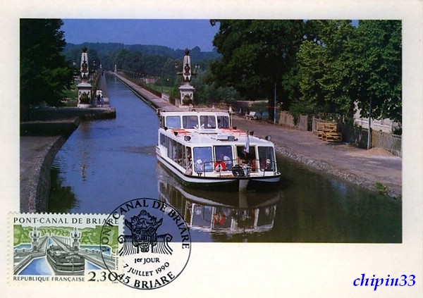
France - Pont-canal de Briare 布里亞爾運河橋


Stamp Issue : 1990-07-07 

Briare Canal Bridge (Pont-canal de Briare) is a metal girder canal bridge, built with the help of the engineer Gustave Eiffel. It is the longest canal bridge in Europe (662.7 meters). It allows both barges and pleasure boats to cross the Loire River and to pass from the left minor canal to the Briare canal. Built from 1890 to 1894, it was opened in 1896. In the late 19th century, this was a major transportation route for commodities and it was an architectural prowess to make such a bridge at that time.


布里亞爾運河橋是金屬梁柱的運河橋,由工程師古斯塔夫艾菲爾協助建造,長662.7公尺,是歐洲最長的運河橋, 此橋幫助駁船和遊艇跨越盧瓦爾河,也幫船隻從左側小運河通到布麗亞爾運河。它興建於1890至1894年間,到1896年才啟用。在19世紀的末葉,它不但是一個主要的運輸路線,也是當時築橋本領高超的一大展現。

Thursday, September 18, 2008

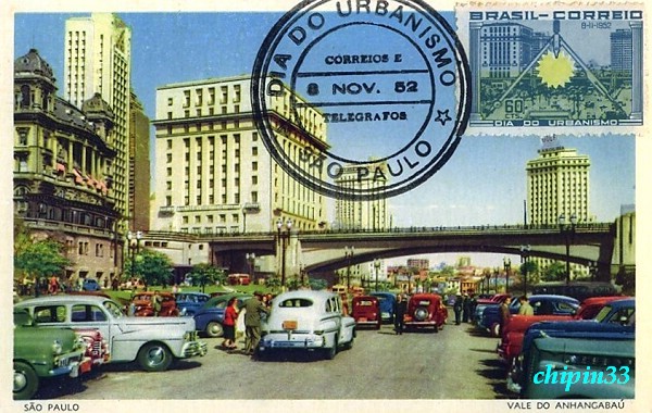
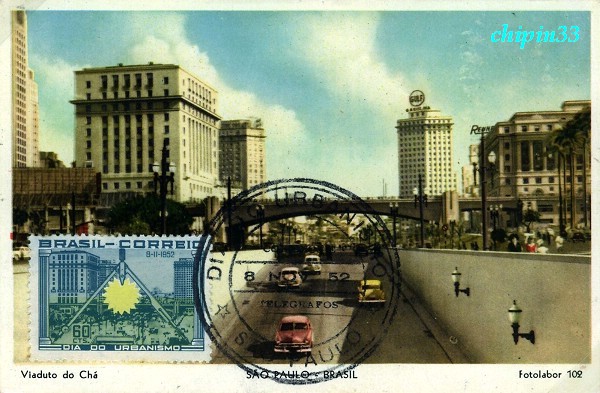
Brazil - Pedestrian Overpass in São Paulo


Stamp Issue : 1952-11-08 

The overpass cross downtown streets in São Paulo. São Paulo is the capital of the state of São Paulo, Brazil. The city is the largest in Brazil and first in South America by population. It is located in the South East of the country. It is also the richest city of Brazil. The name means Saint Paul in Portuguese. The city has an area of 1,523 square kilometres and a population of 10,886,518, which makes it the most populous in Brazil, in South America and in the southern hemisphere. Greater São Paulo, which includes adjacent municipalities, has a population close to 20 million, making it the second largest in the Americas, and one of the largest metropolitan areas in the world.


Wednesday, September 17, 2008

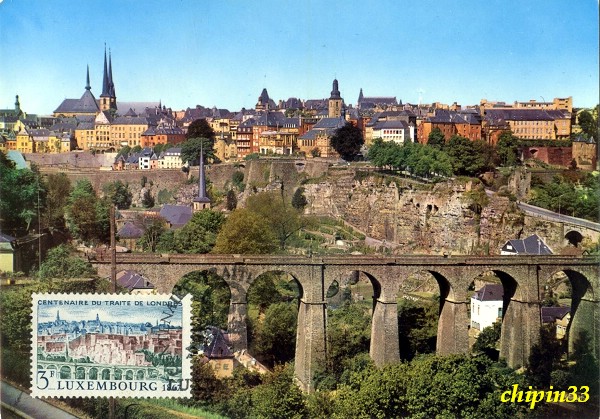
Luxembourg - Passerelle


Stamp Issue : 1967-03-06 

The Passerelle, also known as the Luxembourg Viaduct, is a viaduct in Luxembourg City, in southern Luxembourg. It runs southwards from the city centre, Ville Haute, carrying road traffic across the Pétrusse valley and connecting Boulevard Franklin Delano Roosevelt to Avenue de la Gare. It is 290m long, with 24 arches, and 45m above the valley floor.
It is also known as the Old Bridge (Luxembourgish: Al Bréck, French: Vieux pont, German: Alte Brücke) by people from Luxembourg City. The 'new bridge' in this comparison is the Adolphe Bridge, which was built between 1900 and 1903.
The Passerelle was built between 1859 and 1861 to connect the city centre with Luxembourg's new railway station, which was located away from the city centre so as to not detract from the defensive capabilities of the city's fortress.


Tuesday, September 16, 2008

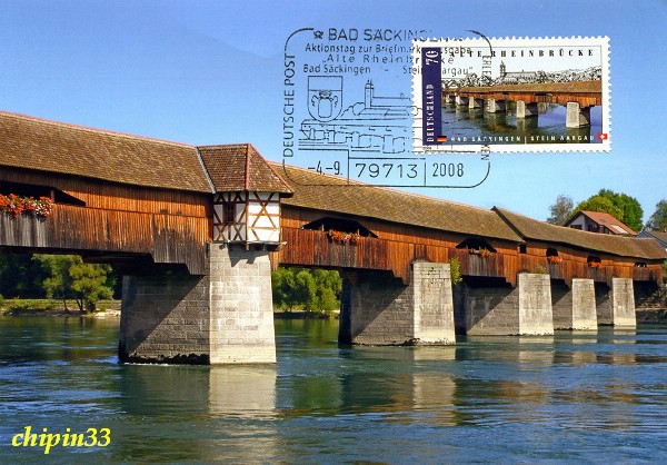
Germany - Bad Säckingen Covered Bridge & Switzerland - Old Rhine Bridge


Stamp Issue : 2008-09-04 

Bad Säckingen Covered Bridge (Old Rhine Bridge) that links Bad Säckingen in Germany with Stein Aargau in Switzerland. It is the longest covered bridge main structure at just over 200 m in Germany, Switzerland and possibly in Europe. It is also Germanys southernmost covered bridge and probably has some of the oldest timbers still in use in a bridge. The bridge belongs to the German town of Bad Säckingen, but it crosses the border into Switzerland at the deepest part of the river. It has been restored many times and used to carry motor vehicles - now it is a pedestrian footbridge.

 
Many thanks Mrs. Kalpana Sharma mail above two beautiful bridge maximum cards of newest Joint issue Germany/Switzerland to me from Germany.


Monday, September 15, 2008

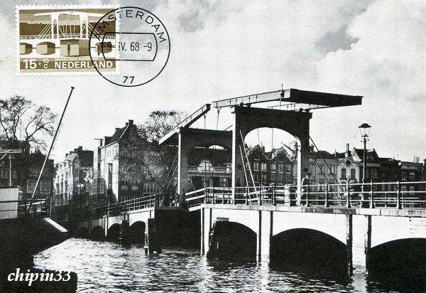
Netherland - Magere Brug


Stamp Issue : 1968-04-09 

Magere Brug ("Skinny Bridge") is a bridge spanning the River Amstel in the city centre of Amsterdam. It connects the banks of the river at Kerkstraat street, between Keizersgracht canal and Prinsengracht canal.
The Magere Brug is a bascule bridge made of white painted wood. It was built in 1934. The first bridge at this site was built in 1691 as Kerkstraatbrug and had 13 passes. Because this bridge was very small, the locals called it Magere brug, which means small or skinny bridge. In 1871 the state of the bridge was so bad that it was demolished en replaced by a wooden bridge with nine passes. Fifty years later this bridge also needed to be replaced. Architect P.L. Kramer made a few designs of steel and stone, but the city decided to replace the bridge with a new bridge that looked the same as the last one, only slightly bigger. In 1934 the bridge was demolished and replaced. The last major renovation was done in 1969. Until 1994 the bridge was opened by hand, now it's opened automatically.
Since 2003, only pedestrians and cyclists are allowed to use the bridge. Many times a day it is opened in order to let ships pass; the boats used for sightseeing tours are low enough to pass underneath the bridge when closed. The bridge is decorated with 1200 light bulbs that are turned on in the evening.


Sunday, September 14, 2008

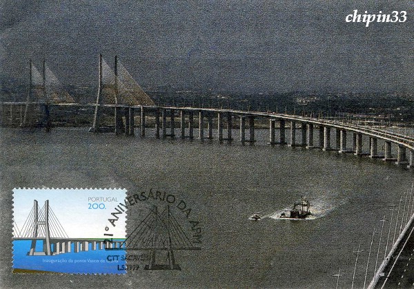
Portugal - Vasco da Gama Bridge


Stamp Issue : 1998-03-29 

Vasco da Gama Bridge (Ponte Vasco da Gama) is a cable-stayed bridge flanked by viaducts and roads that spans the Tagus River near Lisbon, capital of Portugal. It is the longest bridge in Europe (including viaducts), with a total length of 17.2 km, including 0.829 km for the main bridge, 11.5 km in viaducts, and 4.8 km in dedicated access roads. Its purpose is to alleviate the congestion on Lisbon's other bridge (25 de Abril Bridge), and to join previously unconnected motorways radiating from Lisbon.
The bridge was opened to traffic on March 29, 1998, 18 months after construction first began, just in time for Expo 98, the World's Fair that celebrated the 500th anniversary of the discovery by Vasco da Gama of the sea route from Europe to India.