Thursday, April 29, 2010

Argentina - Puente del Inca 印加橋


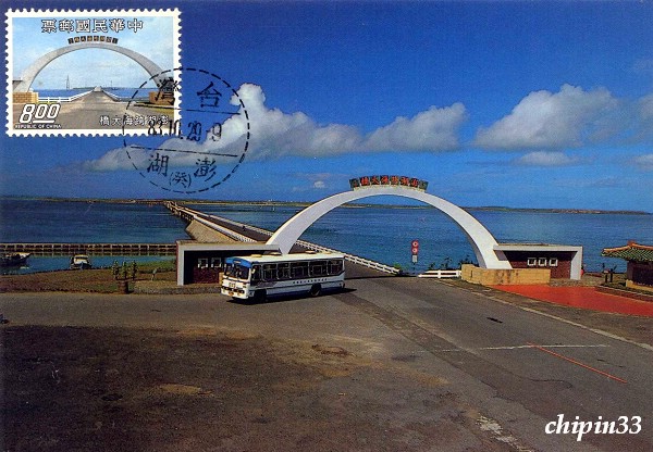
Stamp Issue : 1971-01-30 

Inca's Bridge (Puente del Inca in Spanish) is a small village a few kilometers away from Andes mountain range (Cordillera de Los Andes ) located in northwest of the Mendoza Province in Argentina. There is a natural arch also known as Puente del Inca formed by the river Las Cuevas (Rio Las Cuevas) carving the mountains and sits about 2,700 meters above the sea level on Mount Aconcagua (Cerro Aconcagua ) close to Chile.
This amazing natural landscape is 48 meters long, 28 meters wide and 8 meters thick, sits 27 meters above the river with stalactites in the tunnel. The legend of its formation makes Puente del Inca a nature conservation area and a spectacular tourist attraction for hot spring as well.
Puente del Inca is about 183 kilometers west of Mendoza via Route 7 and is the main passage to Aconcagua Provincial Park.


印加橋是一個小鄉村,也是一條由岩石構造跨越在河穴而形成的一個天然橋樑名稱,位於阿根廷西北部的門多薩省。它座落海拔2700公尺的安第斯山脈,接近智利。
這令人驚歎的自然地貌大約有48公尺長,28公尺寬及8公尺厚,離河面27公尺高,坑內有若干鐘乳石景觀。由於它過去傳奇的形成因素,現已成為自然保護區及一個突出的溫泉旅遊景點。
印加橋往多薩城經七號公路幹線約183公里,也是阿空加瓜省立公園入口必經之途。

Wednesday, April 28, 2010

Algeria - Sidi M'Cid Bridge 西迪美思橋


Stamp Issue : 1974-04-22 

Sidi M'Cid Bridge designed by French engineer Ferdinand Arnodin is an iconic monument of Constantine, Algeria. It is a suspension cabled-stay bridge with main span 160 meters long. Opened on April 19 in 1912, the bridge connects the slopes of Sidi M’ Cid hill to the old town area, with an appalling canyon 175 meters below it. Although the bridge sways while crossing, it is basically safe. In 2000, twelve cables were replaced. Unfortunately, in recent years, Sidi M'Cid Bridge has become a popular suicide destination in Constantine.


西迪美思橋是阿爾及利亞君士坦丁標誌性的古蹟,這條160公尺長的懸索斜張橋,由法國工程師費迪南德阿爾諾丹設計,1912年4月19日通車。該橋沿西迪美思山的斜坡連接到舊城區,距離橋下為175公尺驚人的峽谷深淵,過橋時雖有搖動,但基本上是安全的。於2000年,12條鐵纜換新。不幸的是,近年來這座橋梁已成為君士坦丁流行的自殺目的地。

Friday, April 23, 2010

Taiwan ROC - Silou Bridge 西螺大橋


Stamp Issue : 1954-1-28 

Silou Bridge crossing over Jhuoshuei River in Central Taiwan is the hub of the north-south highway lines. The bridge is 1,939 meters long, 7.3 meters wide with 31 spans. Started in 1937, interrupted during WWII, the construction was resumed in 1952 with US aid and inaugurated on January 28, 1953. The structural steel trusses were supplied by ECA China Mission. It was the longest highway bridge in the Far East back then. The bridge was designed with rails on the deck to carry both road and railway traffic to the Taiwan Sugar Railways network.
More than 60 years old, like many aging bridges Silou Bridge once faced the fate of reconstruction and demolition. As the bridge has become an important local cultural landscape, through the efforts of the community, the government decided to preserve the bridge and its original appearance. However, for safety measure, the rails are removed and only light weight vehicles are allowed.


西螺大橋橫跨臺灣濁水溪,處南北公路幹線中心,橋長1,939公尺,寬7.3公尺,計31孔。始建於1937年,在二次世界大戰期間中斷,於1952年復工,1953年1月28日舉行通車典禮。鋼樑由美援供給,橋面附有鐵軌,以連接兩岸臺灣糖業公司之鐵路網 。為當時遠東最長之公路橋。
高齡已逾60多年的西螺大橋與多數老橋一樣,一度面臨改建或拆除的命運。由於西螺大橋已是當地重要的人文景觀,經過地方人士努力爭取,政府決定繼續保留橋梁原貌不變,但為橋梁安全考量,已拆除橋上的鐵軌,並只限小型車輛通行。

Thursday, April 22, 2010

Taiwan ROC - Penhu Inter-Island Bridge 澎湖跨海大橋


Stamp Issue : 1974-05-15 

Connecting Baisha and Siyu, the two larger islands of Penghu Islands (the Pescadores), Penghu Inter-island Bridge is the only passage between the two islands and is the main artery on the Penghu Islands. It was once the longest bridge crossing over an abyssal zone in Eastern Asia.
Originally built in 1970, the Penghu Inter-Island Bridge was 2,159 meters long, with a 5.1 meters wide single lane and seven 8 meters wide turnouts. Rebuilt in 1984 and completed in 1996, the new bridge is 2,494 meters long, 13 meters wide of which two lanes take up 9.5 meters with the walkway 3.5 meters wide.
The Penghu Inter-Island Bridge and its arched architecture are one of the famous tourist attractions.


連接澎湖群島中的白沙和西嶼兩大島,澎湖跨海大橋是兩島間唯一的的通道,也是澎湖群島主要交通動脈,曾是東亞最長一座跨越深海的大橋。
澎湖跨海大橋建於1970,全長2,159公尺,寬5.1公尺的單車道,有7處8公尺寬之避車道。1984年改建,1996年竣工。新橋全長2,494公尺,寬13公尺,其中雙車道寬9.5公尺,人行道寬3.5公尺。
跨海大橋和橋頭的拱門建築也是澎湖有名的觀光景點之一。

Wednesday, April 21, 2010

Taiwan ROC - Sino-Saudi Bridge 中沙大橋


Stamp Issue : 1978-10-31 

Sino-Saudi Bridge, named after Saudi Arabia’s massive loan support for the bridge construction signifying the friendship between ROC and Kingdom of Saudi Arabia, is a part of the Chung-Shan Freeway (aka North-South Highway, National Highway No. 1). The freeway was one of ROC’s ten major infrastructure construction projects in the 1970’s. Crossing over Jhuoshuei River in central Taiwan, Sino-Saudi Bridge is situated about 3 Km east of Western Mainline Line’s Hsiluo Bridge. The bridge construction was started in April 1976 and completed in October 1978 using prestressed hollow core piles and prestressed beams. There are four driving lanes. The bridge is 2,345 meters long and is the longest bridge in Taiwan.


中沙大橋是七十年代臺灣十大建設主要工程之一,中山高速公路(國道一號,又名中山南北高速公路)的一環,自1976年4月開工,迄1978年10月完成。因工程興工期間,曾接受友邦沙烏地阿拉伯王國鉅額貸款,特將此主要橋樑命名為「中沙大橋」。該橋跨越中部濁水溪,位於西部幹線西螺大橋以東約3公里處。採用預力空心基樁及預力梁建設 ,4車道橋面,全長2,345公尺,為臺灣地區最長之橋梁。

Tuesday, April 20, 2010

Taiwan ROC - Lover Bridge 情人橋


Stamp Issue : 2006-06-30 

Lovers' Bridge , located at Taiwan Tamsui Fisherman's Wharf in Taipei,is a white cable-stayed bridge. The name origins from its opening day February 14, 2003 which is also Valentine's Day. One can enjoy the beautiful sunset on the 196 meters long bridge. The walk takes about 3 minutes.
Under the sun, Lovers' Bridge looks vibrant and lively. In the sunset, the lovers on the bridge form a classic love scene. At night, with the colorful lighting, the bridge shows its mysterious and romantic attraction.


情人橋是一座白色斜張橋,位於臺灣臺北淡水漁人碼頭。這名字源自2003年2月14日開幕日,剛巧也是情人節。在橋上可以欣賞到落日美景,總長約196公尺,步行全程約3分鐘。
在陽光下,情人橋看起來充滿活力和生氣;黃昏時分,夕陽與橋上的戀人構成一幅經典愛情畫面;晚上,在五光十色的燈光下,情人橋更顯示其神秘和浪漫的吸引力。

Wednesday, April 7, 2010

Russia - Bolshoy Moskvoretsky Bridge 波修瓦莫斯柯弗奈斯基橋


Stamp Issue : 1947 

Bolshoy Moskvoretsky Bridge, a concrete arch structures from 1936-1937 that spans the Moscow River at the east side of Kremlin in Moscow, the Capital of Russia. It connects the Red Square and Bolshaya Ordynka Street of Zamoskvorechye.
The bridge was originated as a wooden structure of the 15th Century just east of the Kremlin. In 1829, it was expanded into a tri-arch wooden bridge. After a big fire in 1871, it was replaced by a steel arch bridge. Between 1935 to 1938, all the bridges in central Moscow were reinforced into high capacity bridges. Moskvoretsky Bridge was the first one to complete as the only concrete bridge in the 1930s of the 20th century. The bridge crosses the narrowest point of the Moscow River.
At present the main arch of the bridge stands 92 meters long, 6.1 meters high, and 40 meters wide (with 8 lanes). With approach ramps, the bridge has a length of 554 meters. Although the bridge is a concrete structure, Alexey Shchusev the architect chose pink granite as the facade to make the bridge look as if built by real rock.


波修瓦莫斯柯弗奈斯基橋是位於俄羅斯首都莫斯科橫跨莫斯科河的一座混凝土拱橋,緊接克里姆林宮的東面,連接紅場與熱摩斯弗爾恰的波修雅奧登卡街,建於1936-1937年。
此橋原來是位於克里姆林宮東面建於十五世紀的木橋,至1829年始改建成三拱木橋,1871年被大火燒毀後更換成鋼拱橋。在1935至38年,所有在莫斯科市中心的橋樑被替換為高載量的橋樑。莫斯柯弗奈斯基橋是第一個完成,並且是20世紀30年代唯一的混凝土橋,這座橋被建築在莫斯科河最狹窄處。
目前橋梁主拱長92公尺,高6.1公尺,寬40公尺(8線車道),連引道總長554公尺。雖然是混凝土結構,但建築師阿列克謝休謝夫將橋梁設計成淺紅色的花崗岩磚橋外型,讓人們產生以為這是一座石橋的幻覺。

Tuesday, April 6, 2010

Russia - Crimean Bridge 克里米亞斯基橋


Stamp Issue : 1947 

Crimean Bridge (a.k.a. Krymsky Bridge) is a steel suspension bridge in Moscow. Originally a wood pontoon was built in 1786. Due to wear and tear by flood and ice, the bridge was replaced by the steel arch structure in 1873. Stalin's Moscow reconstruction project erected the current steel suspension structure in 1935. The construction was completed on May 1, 1938.
The length of the bridge is 668 meters, including the approach ramps (with bridge itself taking 262.5 meters, with spans 47.25 by 168.0 by 47.25 meters) and the width is 38.4 meters, including a two lane 24 meter road and two 5-meter food paths. The structure bridges the Moscow River a merely 1.8 kilometers southwest from the Kremlin and in connection with the Garden Ring.
The bridge connects the Crimean Square to the north and Krymsky Val street to the south and runs to two Moscow Metro stations - Park Kultury (Sokolnicheskaya Line) and Oktyabrskaya (Kaluzhsko-Rizhskaya Line).


克里米亞橋又名克里米亞斯基橋是俄羅斯首都莫斯科的一座鋼索吊橋,他原是1786年建造的木製浮橋,由於不堪洪水及冰雪的侵襲破壞,1873年改建為鋼拱橋。在史達林重建莫斯科時代,1935年被拆除遷移,而在原地重建為目前之吊橋,並於1938年5月1日完成啟用。
這座橋連引道總長度668公尺(橋本身262.5公尺,跨度47.25 + 168.0 +47.25公尺)。 橋寬38.4公尺,包括一個6線24公尺車道和2線 5公尺的行人通道。位於克里姆林宮西南1.8公里,連接花園環道,橫跨莫斯科河。
通過這座橋連接到北面的克里米亞廣場與南邊的克里米亞斯基瓦爾街,接近莫斯科地鐵的文化公園站(莫斯科地鐵1號線)和奧克佳布里斯卡亞站(莫斯科地鐵6號線)。

Monday, April 5, 2010

Taiwan ROC - Tainan Anyi Bridge 臺南安億橋


Stamp Issue : 2010-03-10 

This bridge links two historical sites, Anping Fort (Fort Zeelandia) and Yizaijincheng (Eternal Golden Fort), hence its name Anyi. Spanning the Tainan Canal, it is 120.3 meters long and 25.5 meters wide. Near the bridge on the right bank you can find the old Anping village, the old Tait & Co. Merchant House, the Anping Artillery Fort and the Anping Fort, a national Grade I historical site. Opened to traffic in November, 2003, this bridge has an observation platform, which is a great place to enjoy sunsets and views of Anping Harbor.


橫跨臺南運河,連結安平古堡與億載金城兩處古蹟。92年11月通車。橋長約120.3公尺,寬約25.5公尺。右岸靠近舊安平聚落,鄰近國家一級古蹟安平古堡、德記洋行、小砲台。2003年11月通車,橋上之觀景臺可供觀賞落日餘暉、眺望安平港區風光。

Sunday, April 4, 2010

Taiwan ROC - Tainan Wangyue Bridge 臺南望月橋


Stamp Issue : 2010-03-10 

Located in the Anping District of Tainan City, this bridge spans the Tainan Canal. Opened to traffic in August, 2001, it is 36 meters long and 21.2 meters wide. This bridge has a blue arch design and its railings incorporate moon patterns, both full and crescent. One of Tainan City’s landmarks, this bridge is especially beautiful at night when it is spotlighted and the arches of the bridge connect with their reflections on the water.


位於臺南市安平區,橫跨臺南運河。2001年8月通車,橋長約36公尺,寬21.2公尺,藍色的鋼樑結構,優美的拱形造型,成為台南府城另一新特色地標。兩旁護欄上有月亮圓缺圖形設計,夜間並以投射燈照亮,相當特別,望月橋與水中倒影相映成趣,十分幽美。

Saturday, April 3, 2010

Taiwan ROC - Tainan Qigu River Bridge 臺南七股溪橋


Stamp Issue : 2010-03-10 

This bridge is located in the scenic Qigu Lagoon area, close to the mouth of Zengwen river. Opened to traffic in November, 2007, it has a total length of 440 meters and a width of 40 meters. Its long-span arch design reduces the number of piers needed and reduces its impact on the environment and the ecology. There are walkways along the sides of the bridge, where pedestrians can enjoy views of black-faced spoonbills foraging for food. The arc-shaped railings and the black-faced spoonbill totems blend into the ecological environment seamlessly.


位於七股潟湖風景區鄰近曾文溪出海口。2007年11月通車,橋全長440公尺,寬40公尺,採大跨徑拱橋設計,以減少橋梁落墩數量,降低對環境生態的影響。橋面外側提供人行道空間,可遠眺黑面琵鷺覓食區,圓弧型欄杆配以黑面琵鷺圖騰,充分融入週邊生態環境。

Friday, April 2, 2010

Taiwan ROC - Donggang Jinde Bridge 東港進德大橋


Stamp Issue : 2010-03-10 

This bridge spans the Donggang River in Donggang Township, Pingtung County. Opened to traffic in October of 2002, it has a total length of 440 meters and a width of 21.3 meters, with a 155-meter-long main span and a 30-meter-high arch. A basket-handle steel-arch bridge, it has two box arch ribs, which rise from either side of the bridge and then merge to form a single arch. The deck is supported by a single line of hanger cables. It is a stately looking bridge.


位於屏東縣東港鎮,橫跨東港溪, 2002年10月通車,全長440公尺,主橋跨徑長155公尺,寬21.3公尺,拱高約30公尺。為提籃型景觀鋼拱橋,兩根箱型拱肋自橋面兩側拱起,交會後合而為一,成一虹型單拱肋,以單面鋼索支撐橋面,造型宏偉壯觀。

Thursday, April 1, 2010

Taiwan ROC - Kaoping River Cable-stayed Bridge 高屏溪斜張橋


Stamp Issue : 2000-02-02 

The Kaoping River cable-stayed bridge across Kaoping River is situated at the border of Kaohsiung and Pingtung Country. The total length of the bridge is 2,617 meters. The western section of it has a nonsymmetrical cable-stayed bridge design. The pylon, its main structure, is a single tower with an A-frame design, with a height of 183.5 meters. It has a side span of 180 meters that uses a prestressed concrete box beam. Its main spain is an extremely long 330 meters, and uses a completely welded steel-frame box beam. The middle section of the bridge, for which a balanced-cantilever design has been employed, has long spans. The eastern section of the bridge, which employs an advancing-shoring design, has spans of medium length. This magnificent and powerful design of the bridge as a whole is a triumph both of structural mechanics and esthetics.


高屏溪斜張橋位於臺灣高雄、屏東兩縣交界處,橫跨高屏溪,全長2,617公尺;西段採單塔不對稱式斜張橋設計,主體結構橋塔A字型,高183.5公尺,側跨跨徑180公尺,為預力混凝土箱型梁,主跨跨徑330公尺採全焊接式鋼結構箱型梁;再由西至東分段採大跨徑之懸臂工法橋及中等跨徑之支撐先進工法橋設計,深具結構力學與美學特色。